Executive Summary
Halifax Cycling Coalition (HCC), as part of the 2023 Let’s Walk, Roll & Ride, Spryfield! Program undertook a Cycling Audit on October 15, 2023. This report summarizes the findings of that audit which we hope will inform and motivate improvements to the cycling infrastructure in Spryfield.
The Spryfield community has many of the attributes of a complete community. Many amenities are available within the community and there is a mixture of densities of housing. Unfortunately, the community is an island when it comes to active transportation in general and cycling in particular. In this regard, Spryfield is completely isolated from the rest of Halifax with no direct route to or from the peninsula that is not highly unsafe and uncomfortable to cycle.
As this audit confirmed, even within the community, cycling to key destinations is not well supported. There is no protected All Ages and Abilities (AAA) infrastructure and very few even painted bike lanes. Bike racks are missing from key destinations.
The good news is that the main thoroughfare in Spryfield, Herring Cove Road, is slated for major rework to include cycleways and good sidewalks and transit priority lanes. It is very important that this work continues right to the Armdale Roundabout and that the roundabout itself be made safer for people cycling and walking. This project will make a huge difference and it cannot happen soon enough.
After detailing the methodology and the findings, we identify a number of other next steps, many of them low cost to implement, that will improve cycling in Spryfield.
Methodology
We solicited input from a number of people who live and work in Spryfield to determine a set of key destinations. The key destinations we identified and used in the audit were:
- Cunard Junior High (closed, approaches and parking light)
- Sobey’s grocery store (open, approaches and parking with moderate traffic)
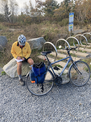
- Long Lake Park (open, approaches and parking with light traffic)
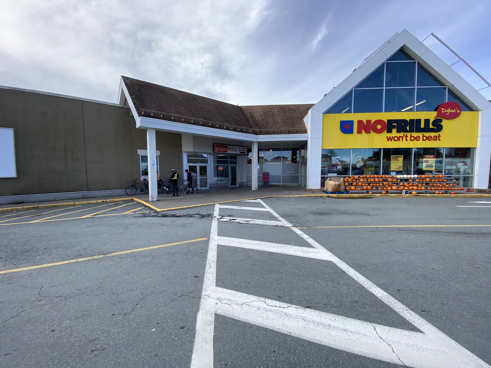
- No Frills grocery store (open, approaches and parking with moderate traffic)
- Graves-Oakley Baseball Field (open, approaches and parking with heavy traffic)
- JL Ilsley High School (closed, approaches and parking light)
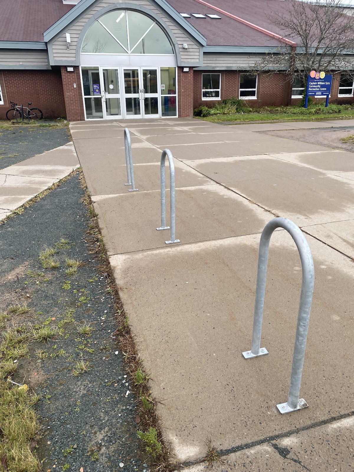
- Captain William Spry Community Centre (open, approaches and parking with light traffic)
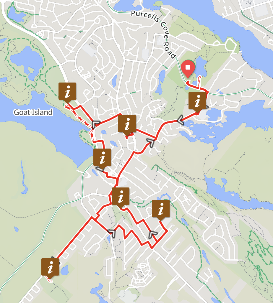
We then developed a route that connected all the key destinations. The starting point was the Frog Pond parking lot, selected as it is a convenient meeting place which can be reached via Purcell’s Cove Road, a less stressful cycling route than Herring Cove Road. To make route connections between destinations, we used Ride with GPS and their heatmap facility which shows routes that are most used by people on bicycles.
The route was not intended to simulate anyone’s lived experience, but by testing approaches to key destinations we effectively produced a sampling of typical experiences. The route followed these streets, in order (key destinations highlighted): Frog Pond, Purcells Cove Road, Williams Lake Road, Cunard Junior High, Williams Lake Road, Clovis Avenue, Circle Drive, Herring Cove Road, Sobey’s, Herring Cove Road, Old Sambro Road, Dunbrack Street, Cowie Hill Road, Long Lake Park, Lakeview Trail, Spencer Avenue, Lewis Street, Dentith Road, No Frills, Herring Cove Road, Sussex Street, Kidston Road, Olie Street, Elgin Street, Dekker Street, Rockingstone Road, Leiblin Drive, Ball Field, Leiblin Drive, Rockingstone Road, Ardwell Avenue, T Tartan Avenue, Athlone Avenue, Thornhill Drive, Auburn Avenue, Herring Cove Road, Sylvia Avenue, JL Ilsley High School, Sylvia Avenue, River Road, Drysdale Road, Herring Cove Road, Community Centre, Sussex Street, Herring Cove Road, Williams Lake Road, Purcells Cove Road, Frog Pond.
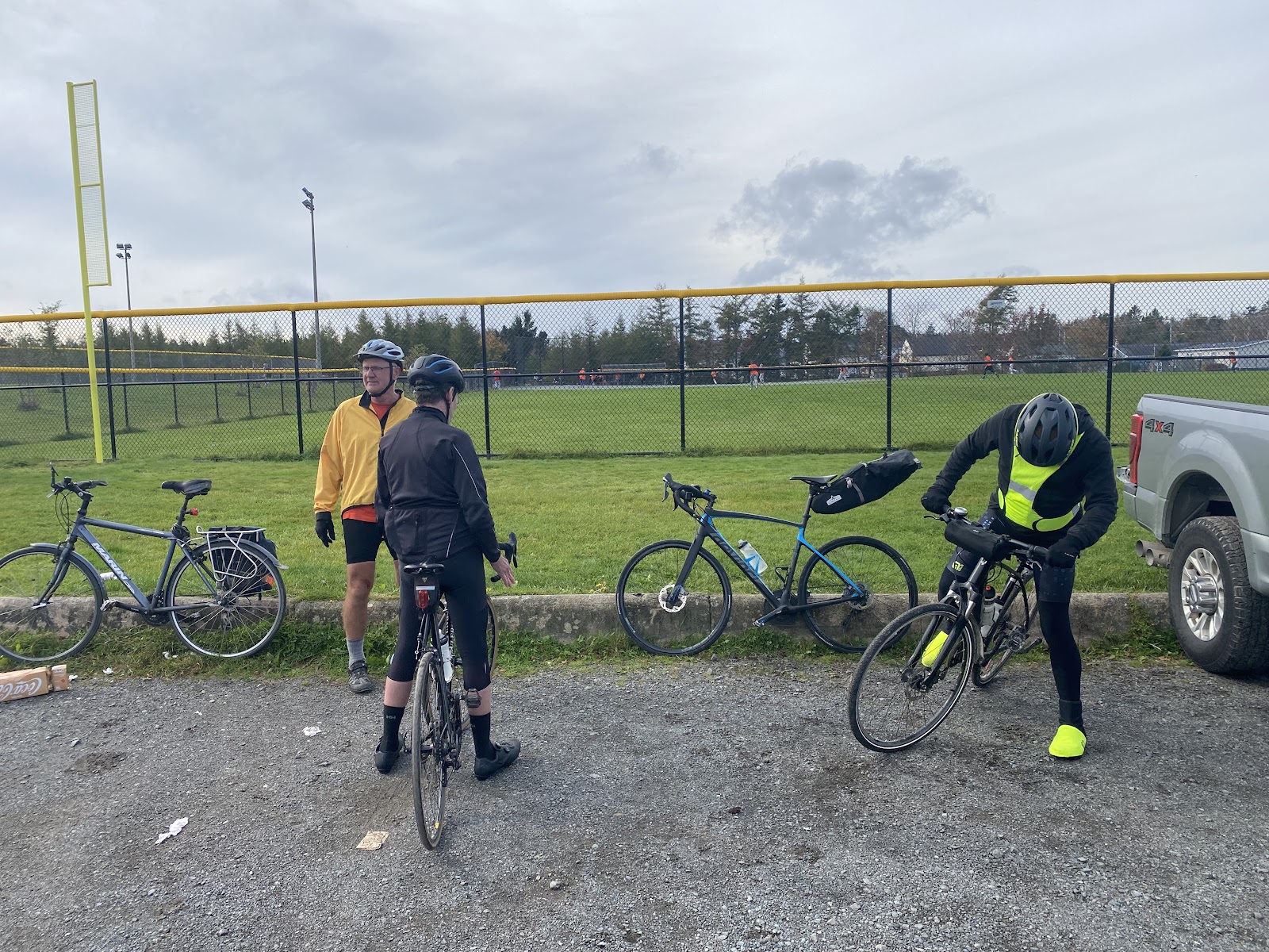
We then solicited riders to take part in the audit through our newsletter (readership 1,500), social media and publicity for the Spryfield program.
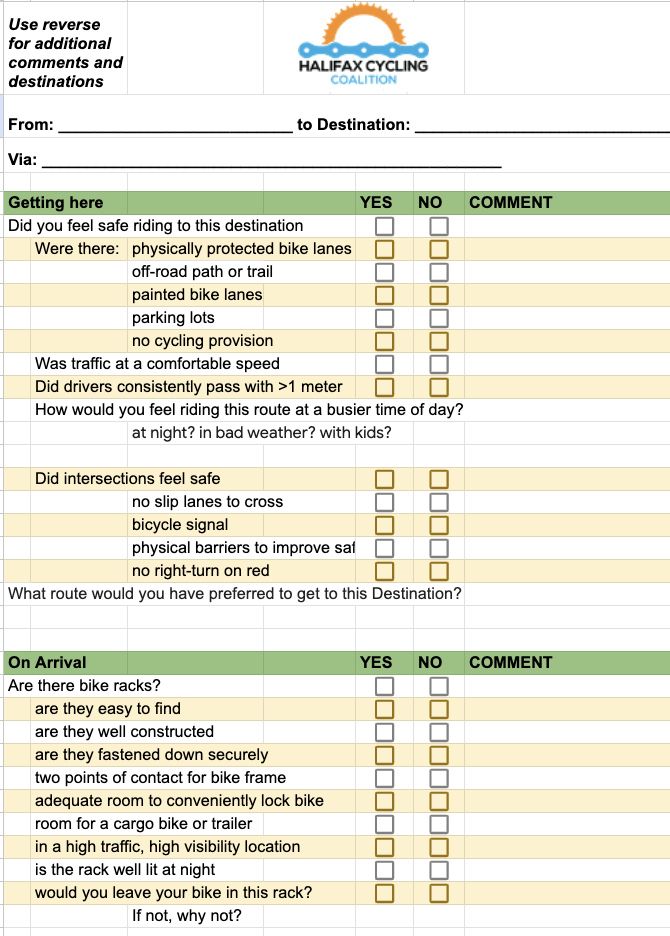
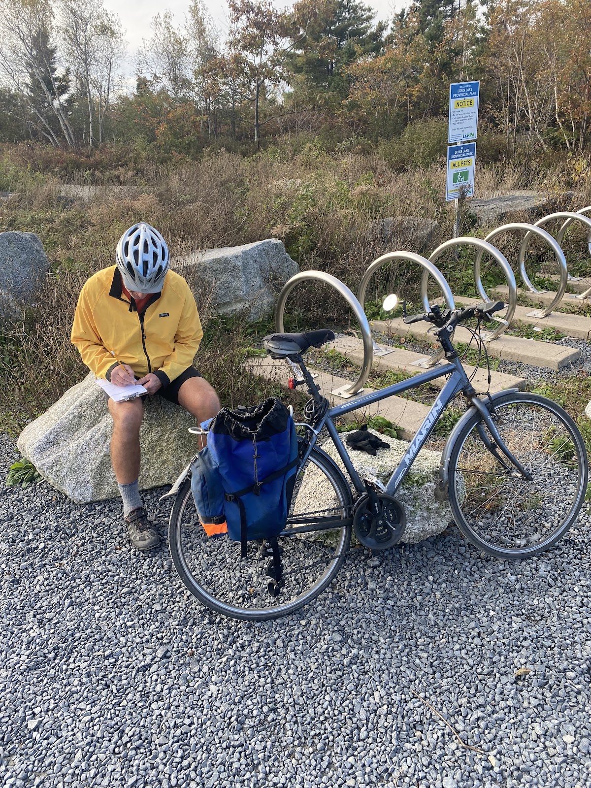
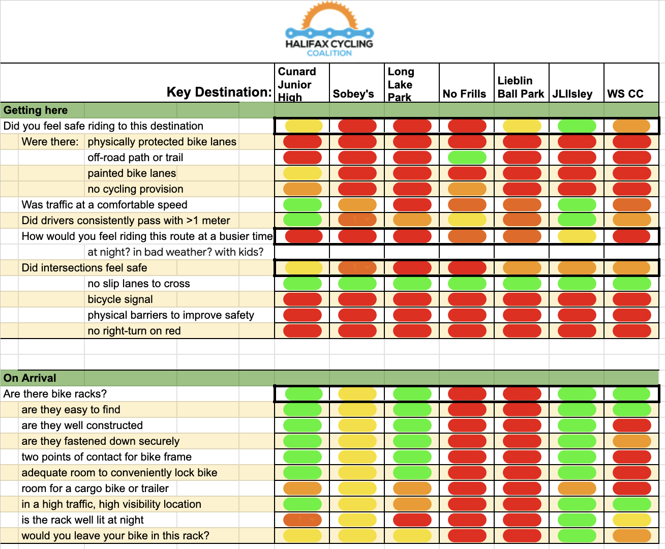
On Sunday, October 15, 2023, between 10 am and noon, we rode the above route. At each key destination, riders were asked to evaluate the cycling conditions to get to the destination as well as the destination itself (mainly the bike racks). The evaluation instrument is reproduced below:
We also used a GoPro camera mounted on the lead bike to record the ride, summarized in a video to be released later, separately from this report.
Colour codes were later assigned to each question on the evaluation sheets to summarize riders’ feedback, where Green represents a unanimous good result, Red represents a unanimously bad result, and Yellow and Orange represent intermediate results.
Limitations
We would have liked to include Mumford Transit Terminal as a key destination but we did not, knowing that we would be asking riders to ride a route that would have taken them on very dangerous sections of streets such as Herring Cove Road up from the Armdale Roundabout, the roundabout itself, Chebucto Road up from the roundabout and Mumford Road.
Because we knew the route would include sections of Herring Cove Road which had no cycling infrastructure, we warned potential participants that they would be riding in fast traffic and not to participate if they were not comfortable doing that. This introduced a bias to potentially rate infrastructure as more comfortable than less experienced riders would, but we also asked riders to try to put themselves in the shoes of a less experienced rider. Time constraints also probably contributed to a relatively small number of riders (4 in total). Our riders did not represent the diversity we would have liked.
We deliberately scheduled the ride for a Sunday morning so that riders would not find the route too stressful. Clearly though, typical conditions most of the time would be in much heavier traffic.
Findings
Data collected by auditing riders is summarized in the following chart (green is good, red is bad, yellow and orange are intermediate):
Highlights
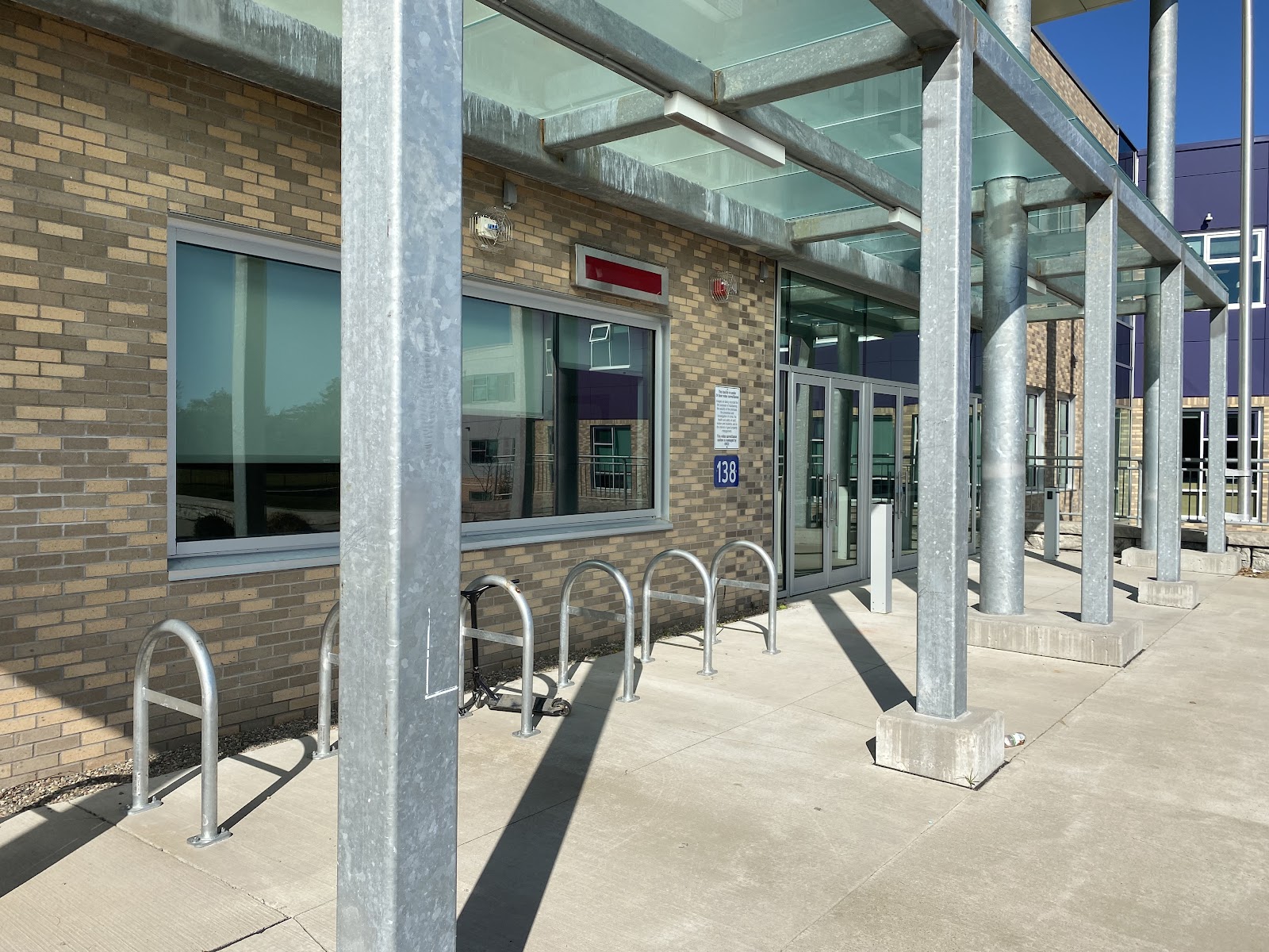
Three of seven destinations had relatively high-quality bike racks although capacity would likely be inadequate in the future when we succeed in shifting transportation modes toward cycling. That was particularly notable at the two schools.
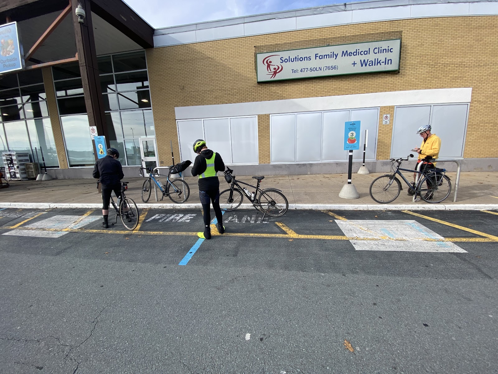
A fourth destination (Sobeys) had steel rails that might have been intended as bike racks (and pretty good ones) but we weren’t sure if that was the intention. See the photo:
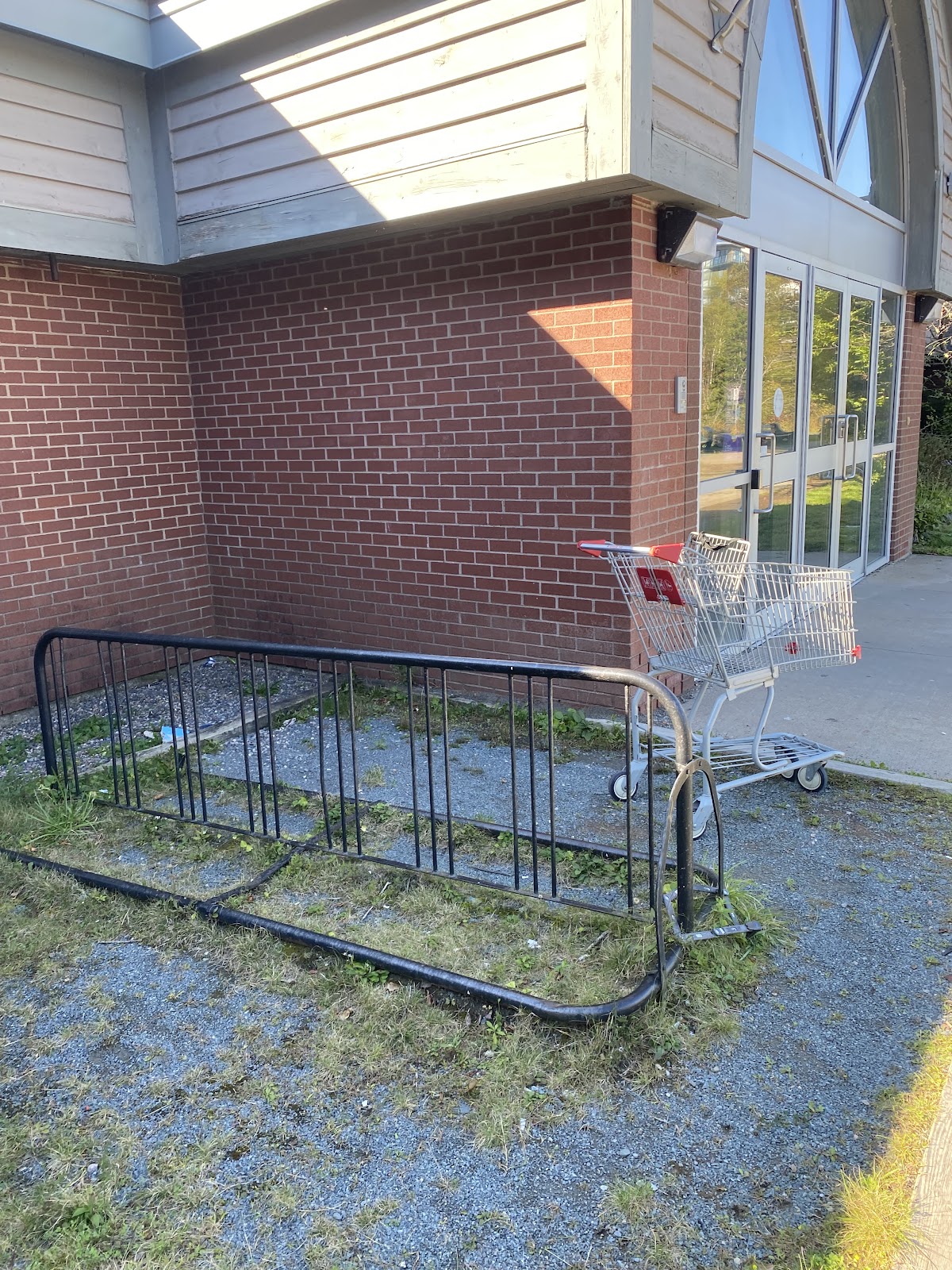
On the other hand, the bike rack at the Community Centre was of very poor quality:
Additional good-quality racks were installed after our audit in preparation for the Mayor’s Bike Ride:
Happily, we did not encounter any slip lanes (dedicated right turn lanes inside an island) which are notoriously dangerous to cross for people cycling and walking.
The approaches to the two schools were the least stressful route segments, mainly because they largely or completely avoided Herring Cove Road.
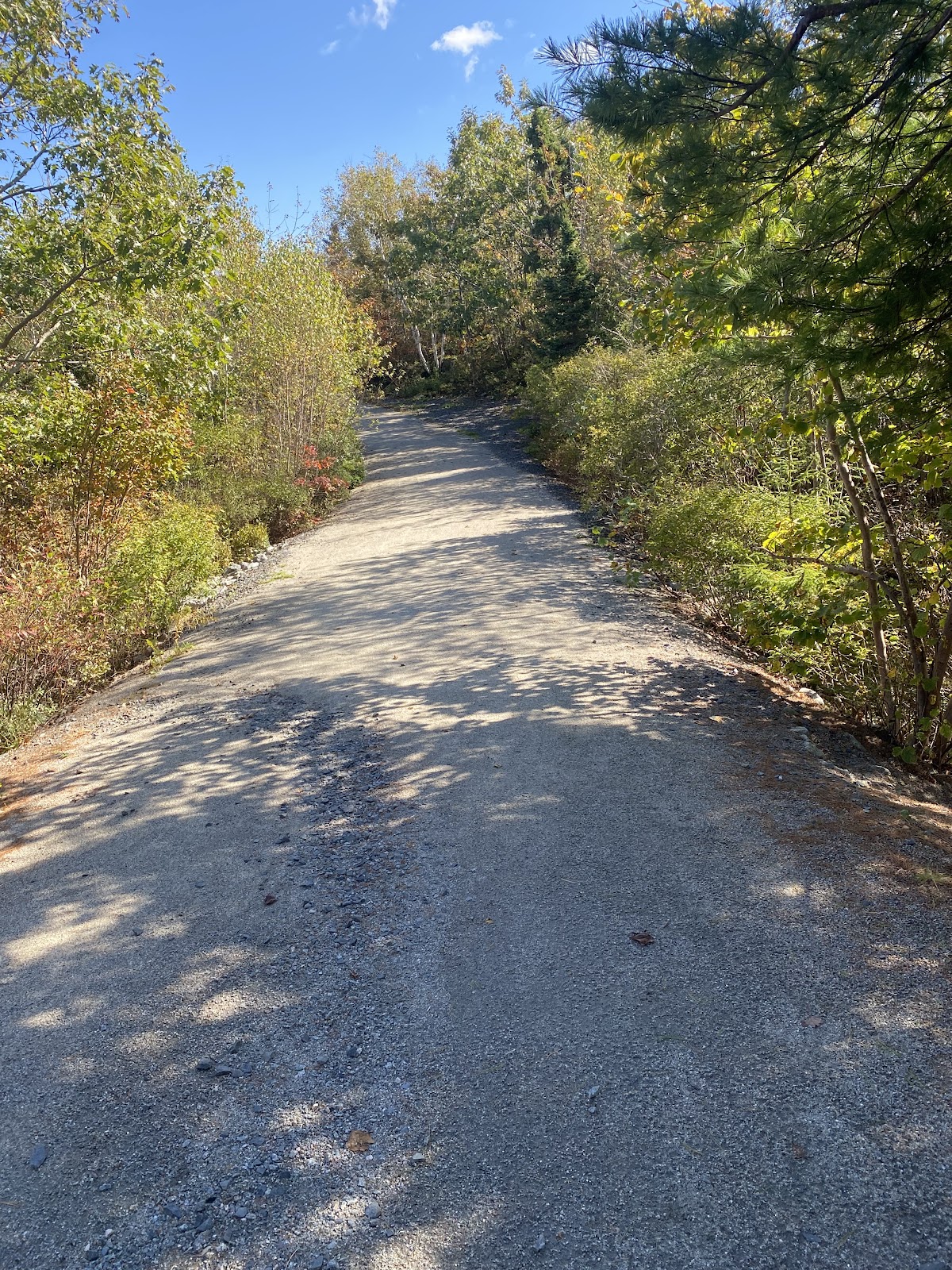
There are some beautiful off-road facilities in Spryfield:
Lowlights
Total lack of bike racks at the No Frills (and that entire shopping plaza) was discouraging.
Even worse was the absence of bike racks at the Graves-Oakley Baseball Field, a recreational facility run by HRM.
No approach to a key destination felt completely comfortable, particularly when riders tried to put themselves in the shoes of a less-experienced rider or under less ideal conditions. This sadly reflects the current state of cycling conditions in Spryfield.
Room for Improvement
Cycling in Spryfield will be dramatically improved when Herring Cove Road is reconstructed, as planned, with dedicated cycleways, sidewalks and transit priority lanes. Research has shown that where cycleways are present, streets are safer for all users, including drivers. This project cannot be implemented quickly enough! The Dunbrack Greenway, outlined in the Active Transportation Priorities Plan, could serve as another important trunk cycling route in the Spryfield area if it is extended to Old Sambro Road as envisaged.
Low Hanging Fruit
There are short-term, relatively inexpensive opportunities for improvement:
- Add good-quality bike racks at Graves-Oakley Baseball Field
- Install bike racks at the Spryfield Shopping Centre / No Frills plaza – either through friendly pressure or a municipal incentive
- Add tactical protected bike lanes on Williams Lake Road until permanent installation can follow
- Add a flashing beacon crosswalk on Williams Lake Road across from the junior high
- Add tactical protected bike lanes on Leiblin Drive until permanent installation can follow
- Explore opportunities to add wide (>=3m), paved neighbourhood connectors which can make it possible to weave a path through quiet residential streets, avoiding main roads
- Do a more comprehensive study to identify and prioritize more improvements